

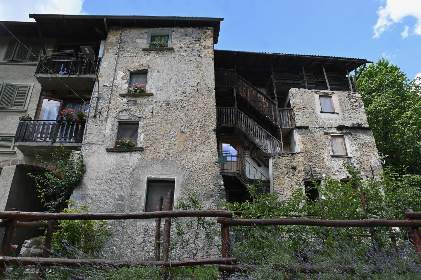
This is the first settlement that you meet after entering the territory of Averara. Ancient, solidly-constructed buildings can be seen: some of them reach a height of four storeys, plus the attic. The various levels are connected by external staircases supported by a timber structure that also includes balconies.
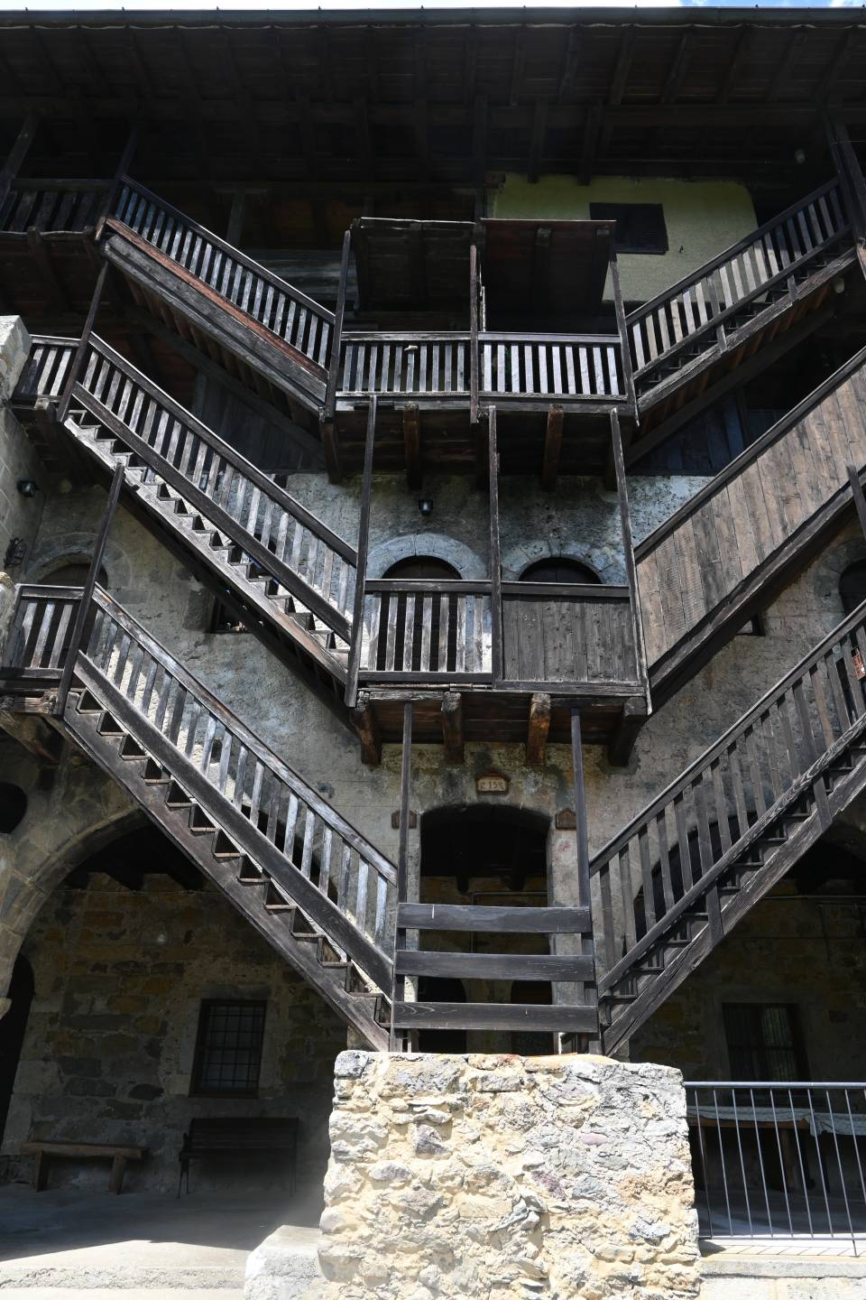
This attractive building looking onto the Mercatorum Way has been identified as a “Venetian customs house.” Various distinctive features make it an important landmark in the history of the valley, as a result of its specific architectural forms. It was probably constructed in the 16th century, incorporating another smaller pre-existing building, perhaps as a result of the need to create new spaces to accommodate men and functions. Above the wide base arcades, the façade has two lateral masonry avant-corps that enclose a large space within which stand the splendid wooden stairs, whose construction probably dates back to a period after the building’s structure had been completed. There is a whole sequence of stairs, skilfully and attractively designed to reach the three floors of the house in a fan-shape with, at the centre, the three landings from which the flights of stairs run, arranged symmetrically on both sides. The house was built in at least three phases, the second of which gave it a large portico, probably used for trading functions.
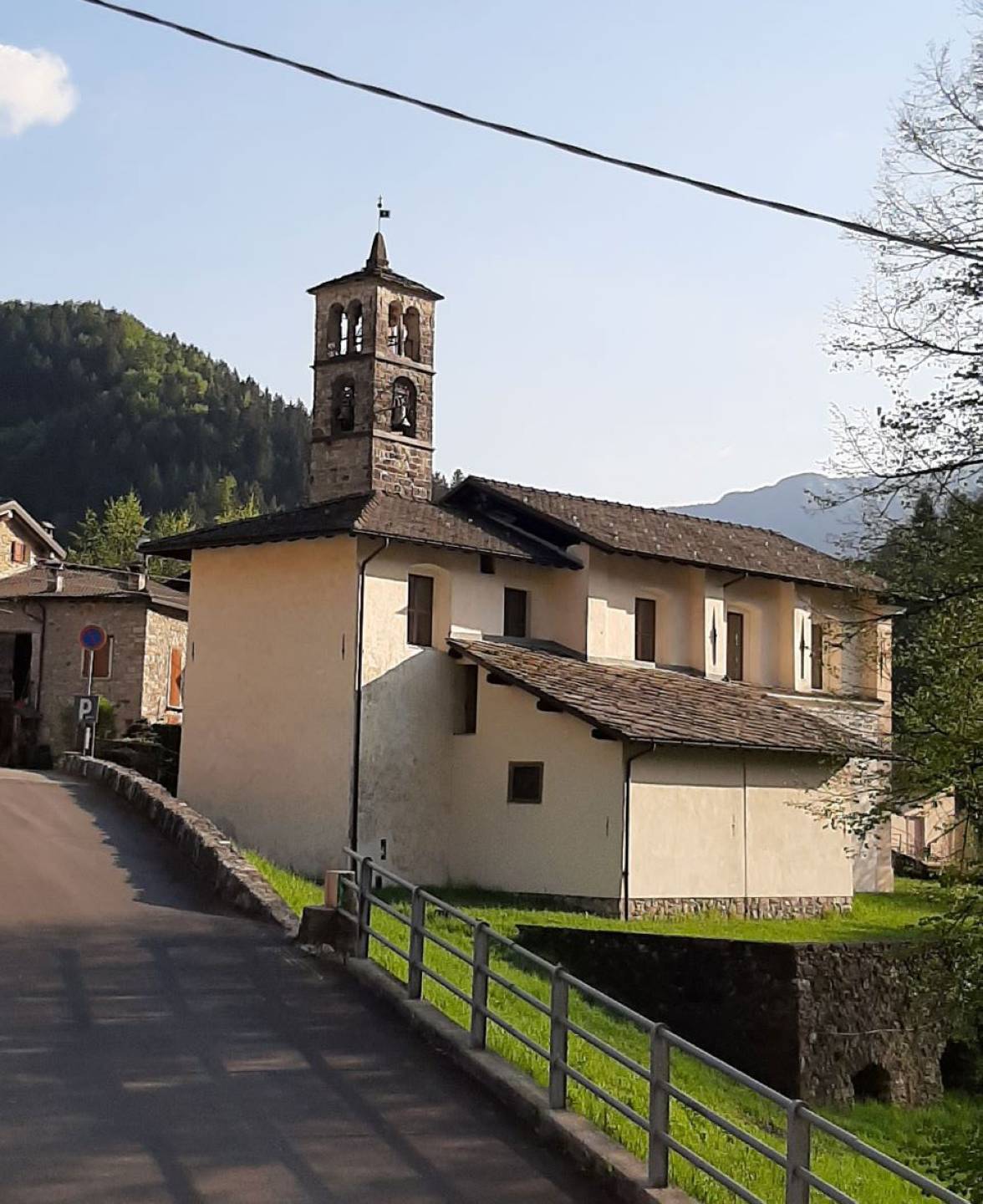
Along the ancient Mercatorum Way, on a spur of pastureland with fine views, in the hamlet of Redivo di Averara, for centuries the location of the Venetian Vicariate, an oratory dedicated to Saint Pantaleone, the physician saint from Nicomedia in Bithynia venerated for providing protection against disease, was built as early as the 13th century. The saint’s day has been celebrated ever since, still today, on 27 July. The building was reconstructed in the 15th century in the local Romanesque-Gothic style, with a simple hall and square presbytery, decorated on the walls and façades with frescoes of which fragments are still visible. A slender bell tower is given a dynamic appearance by the sequence of apertures, from single to triple lancet windows. The bell tower can boast the oldest bells in the valley, dating from 1496 and 1502, joined by a third in 1954. The church was consecrated in 1488 by the Milanese archbishop Rolando dei Conti di Rovellasca. In the second half of the 17th century it was extended and its height was increased, giving it its current appearance. Inside, within the impressive marble surround in the presbytery, there is a fine a painting by Andrea Michieli, known as il Vicentino (1567-1617), from the school of Tintoretto, with Saint Pantaleone and Saints Francis and Charles. The presbytery choir stalls are a notable example of carving and inlay work, signed and dated 1706 by Pietro Milesi. The fresco on the presbytery vault depicting the beheading of Saint Pantaleon dates back to the 19th century.
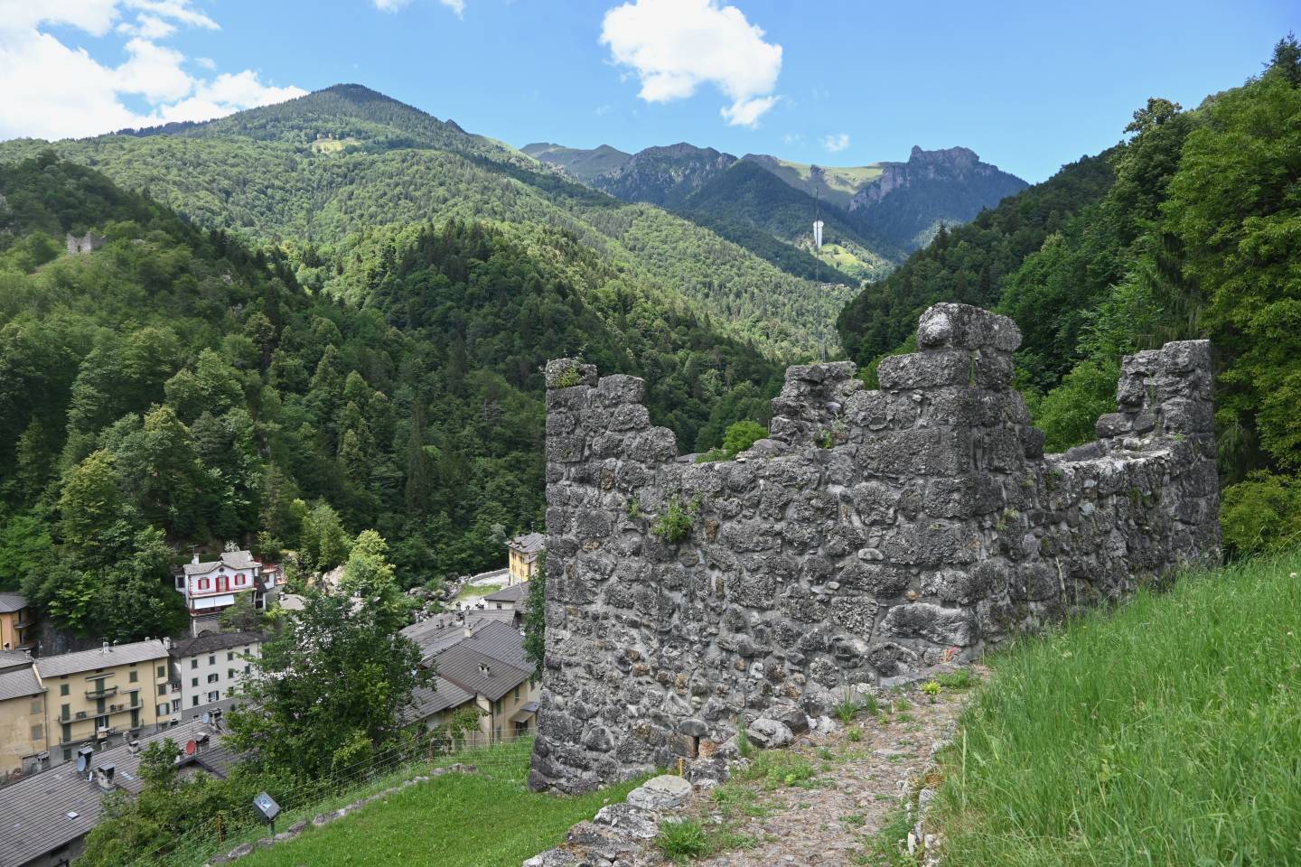
From the tower there is an extensive view of Averara below. The earliest documents attesting to the village’s existence date back to the year 917, and comprise the oldest text in existence concerning the upper Brembana valley, to the point that it is thought that the place name also referred to the entire surrounding area.* However, according to popular belief, the first permanent settlements in this area can be traced back to the time of the barbarian invasions, when the populations suffering the raids took refuge in remote places, offering protection from the waves of conquering hordes. It is thought that exiles from nearby Valsassina colonised (presumably in about the 6th century) the territory of Averara. In the Middle Ages, Averara, on the route to Valtellina and a frontier location, had a customs house and three towers. A period of decline set in after the construction of the Priula Way, which deviated part of the traffic to Mezzoldo. The remains of the Fontana tower and that above the river Corna testify to the important role that Averara played within the upper Brembana Valley in the Middle Ages.
Two towers are located in a strategic position: one on the Mercatorum Way, near the small fortress that stood in the Castello district, the other on the top of a rocky spur that made it possible to control the valley and the road running up to Santa Brigida, also clearly visible from the former. They were part of an observation system that was based not only on the fortified Castle, but also on another tower, demolished in the 18th century, probably constructed in the low-lying part of Averara. The construction of the two towers dates back to the 13th-14th centuries, at the time of the Guelph-Ghibelline struggles. After the Averara Valley had fallen to Venetian domination, the local administrators obtained the right to guard the fortified towers in the area themselves, thus avoiding the presence of military garrisons. The towers remained active in the following centuries, at least until the 18th century: a 17th-century painting preserved in the parish church of Averara shows the Fontana tower in its complete form, with a pitched roof, a door on the west side and windows on the upper floors.
What was believed to be the first mention of the place name Averara, dating back to the year 917, has no documentary evidence, and was due to the misreading of a parchment from that year, interpreting the form de cabraria as de abraria, whereas it actually referred to an entirely different location. (See G. Medolago, La parrocchia di San Giovanni Battista della Valle dell’Olmo in Mezzoldo – The San Giovanni Battista parish in the Valle dell’Olmo valley in Mezzoldo – in Mezzoldo in Valle Lulmi, 2006, p. 211, footnote 8. The document, mentioned by Mazzi in his Corografia bergomense dei secoli VIII, IX e X – Bergamo chorography in the 8th, 9th and 10th centuries – Bergamo, 1880, was transcribed in the Codex Diplomaticus Langobardiae, volume XIII, col. 815. The parchment is in ACVBg., capitular parchments, parchment n° 4317).
The first reference to the place name arrived over 250 years later, with the mention “In casa filiorum Girardi de avrera,” namely “in the house of the sons of Girardo di Averara” that appears in a deed on a parchment dated 1 August 1181, preserved in the Archive of the Bishop’s Curia of Bergamo. (ACVBg., capitular parchments, parchment n° 2392. This document is also referenced by Mazzi in his Corografia bergomense).
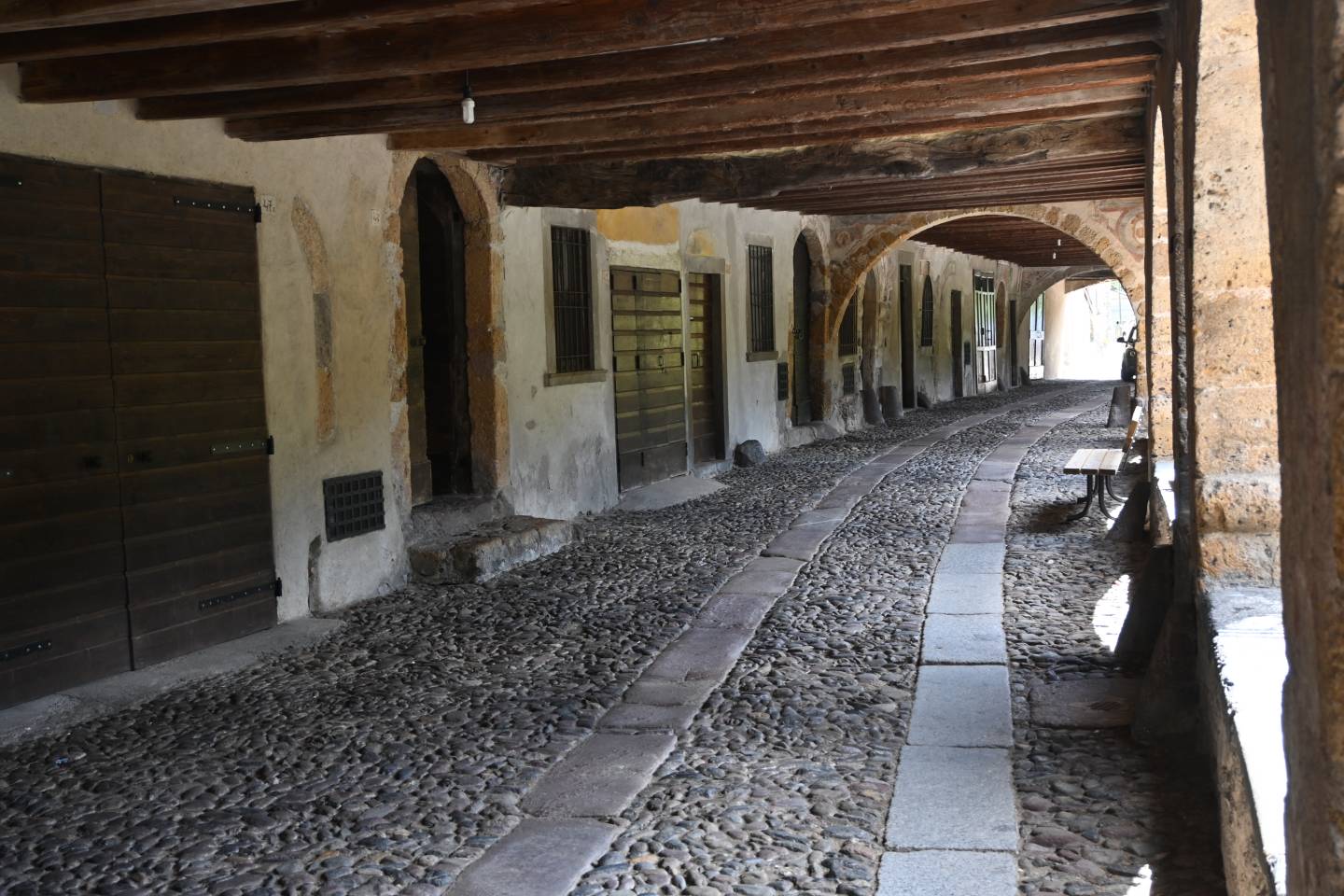
One of the most famous spots of the entire Brembana Valley, an almost totally intact example of a trade setting spanning the centuries. The entire length of Averara’s porticoed street can be seen, with the arched vaults, the windows decorated in trompe l’oeil, and the large central coat of arms. But everything, even the inner vaults, was decorated in the past. Here, alongside the cobbled paving with the two flagstone strips, were the merchants’ and painters’ shops, taverns and lodgings. The street had to be taken by everyone passing through (the street by-passing the centre further down did not exist), from one gate to the other, stopping to pay tribute to the holy shrine. Today there is silence, with just the rush of the torrent. Time has passed, traffic has moved elsewhere.
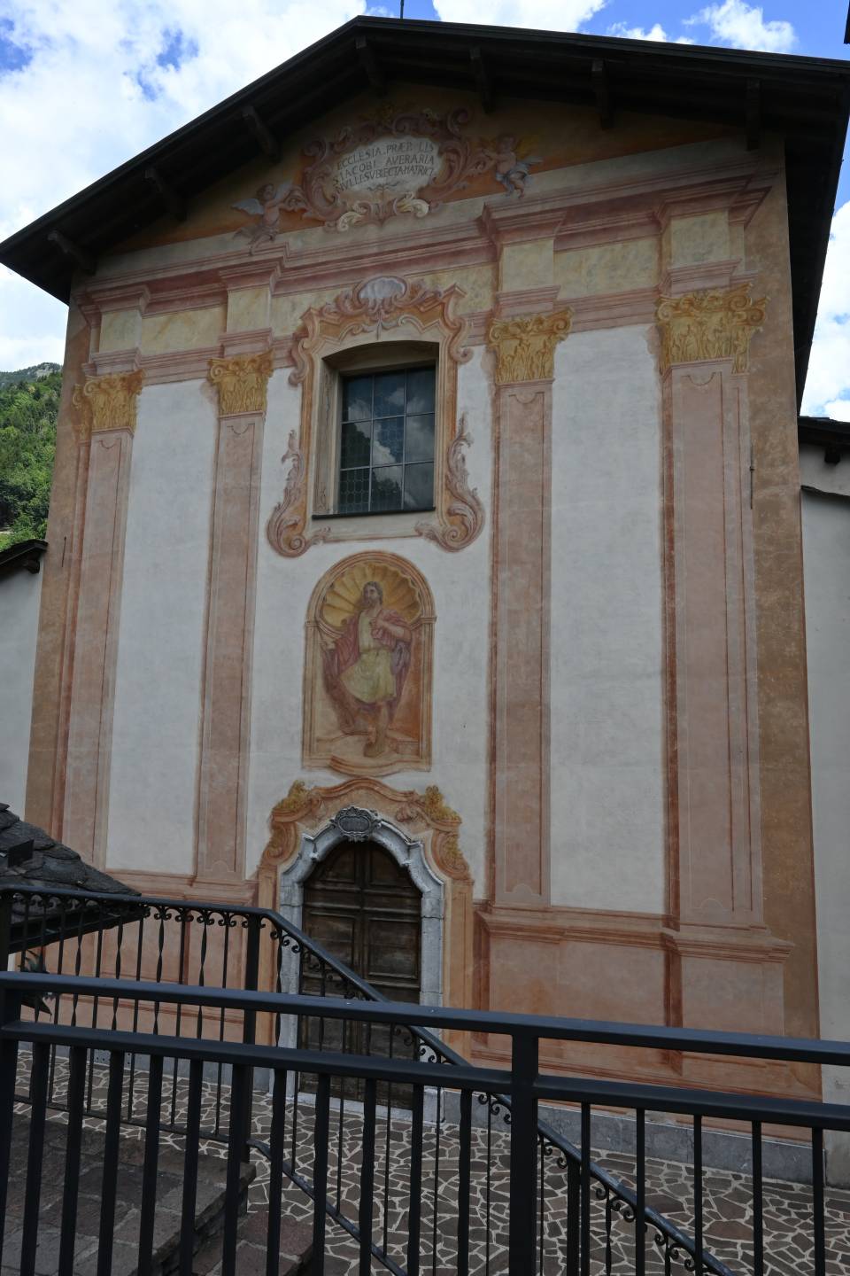
In the “Privileges” that Venice granted to Averara in 1443, there was permission for the municipality to spend part of the census income on the church. The first building was consecrated in 1468 by Bishop Paolo Nicopolitano of Milan, because the Averara Valley was a diocese belonging to that city. The church was later made a parish church by St Charles Borromeo, here on a pastoral visit, on 23 October 1566. The church was originally completely frescoed on the walls, along the façades and under the high portico, where parts of the ancient and artistically-interesting frescoes by the local painters can be seen, including those by the famous Baschenis family, and the grandeur of the ancient church, enlarged between 1713 and 1732, can be admired. The portal in “lumachella” marble from Mezzoldo, surmounted by an ancient fresco depicting St James, is particularly attractive. The parish church was reconsecrated on 2 August 1901 by Bishop Gaetano Guindani. Among the works of art are the altarpiece of the Virgin Enthroned with Saints Apollonia, Anastasia, Catherine and Lucy, by Gian Battista Guarinoni dated 1576, and the altarpiece of the Assumption, above the door to the smaller church, by Lucano Gagio d’Imola, an assistant to Lotto, painted in the early 16th century. The central 1621 altarpiece of Saint James is by Anzolo Lion, while the two canvases on each side, with Saint Joseph and the Angel with Child, are by Marziale Carpinoni. The altarpiece depicting the angels with the dead Christ and Saints Francis and Charles Borromeo, dating back to the early 17th century, is in Venetian style. It is very interesting historically because it depicts the ancient settlement of Averara with its porticoed street and watchtower. The timber furnishings are true masterpieces of local art. The choir stalls and kneeler, inlayed works by Antonio Rovelli of Cusio with carving by Antonio Lozza of Bergamo, were made in 1690-92, with additional work in 1722 by Gio Paolo Caniana. The same artisans made the wall benches and furniture in 1692, behind which the ancient presbytery frescoes can be seen through panels that can be opened. The pulpit is another superb piece of carving and inlay by Antonio Rovelli dating back to 1696, and likewise the large sideboard in the sacristy. The organ is a late 18th-century Serassi, rebuilt by Prospero Foglia in 1844. The external fresco depicting the Tower of Wisdom (1446), an original mnemonic scheme with doctrinal and catechetical rules, is an interesting feature.
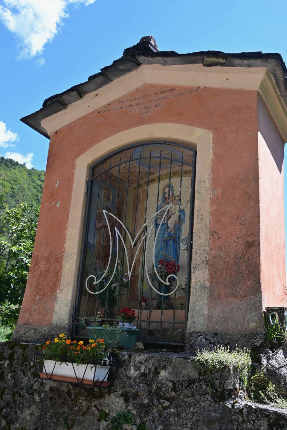
A sacred shrine of modest workmanship commissioned by the Lazzaroni family in 1880; in the niche there is a fresco of the Madonna of the Sacred Heart; at the sides, figures of saints.
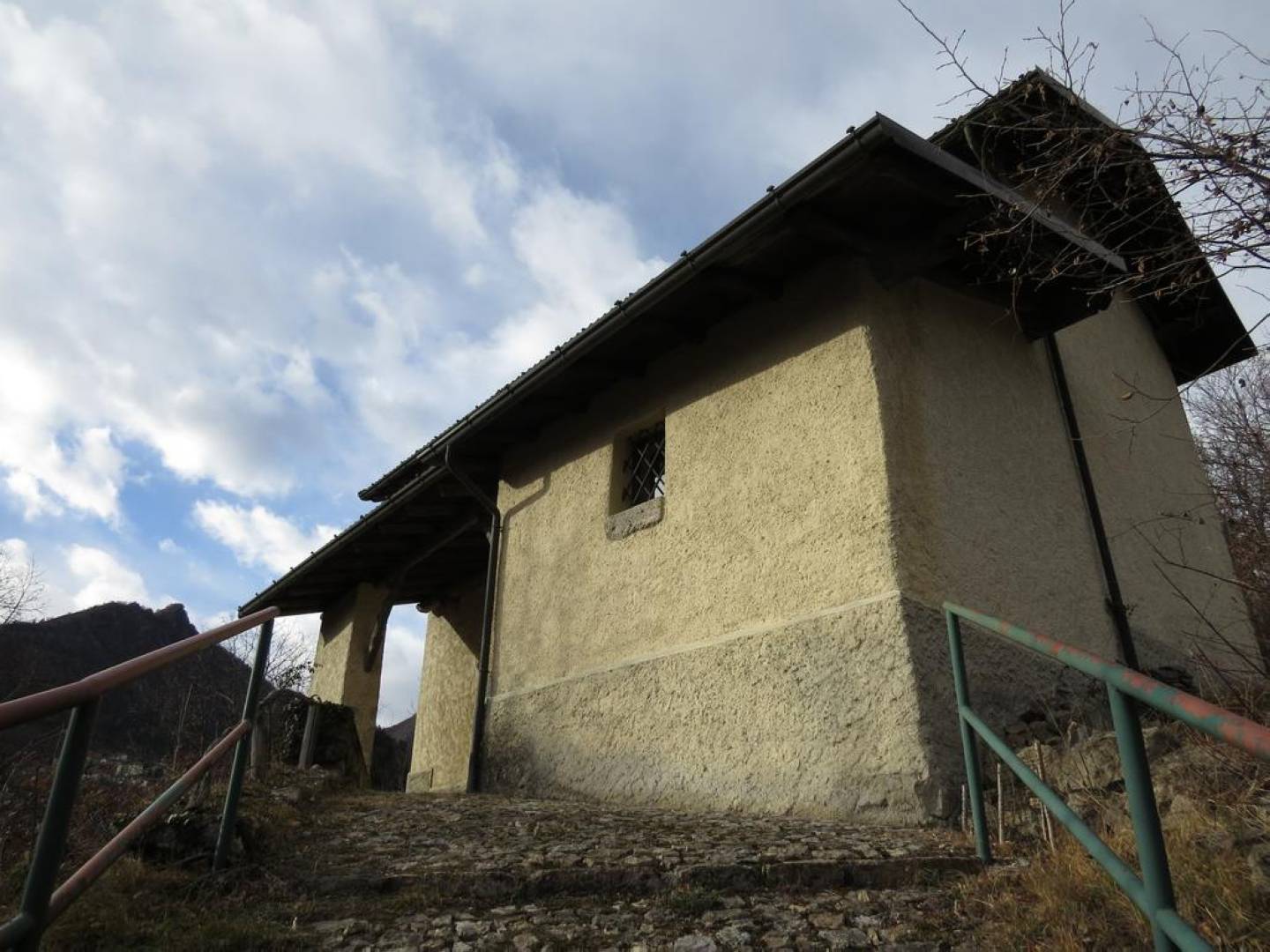
Situated on a hill in an isolated position overlooking the Mora valley, it is documented as early as 1588 as an oratory dedicated to the saint providing protection from the plague. The parish archives of Averara provide information about Ambrogio Rovelli – from the Rovelli dynasty of Cusio – who in 1710 made “the frame for the semicircular choir” and the Bianchi dynasty – painters of Como origin – who moved to Averara in the early 18th century and worked for the parish church and the Oratory of San Rocco until 1796. Among the church’s possessions are a fresco taken from another location and depicting the Madonna and Child, dating back to the 15th century, a wall fresco from the 16th century, the 1632 altarpiece with Saint Roch, Saint Nicholas of Tolentino, Saint Anthony of Padua and Saint Sebastian, and an 18th-century painted wooden crucifix.
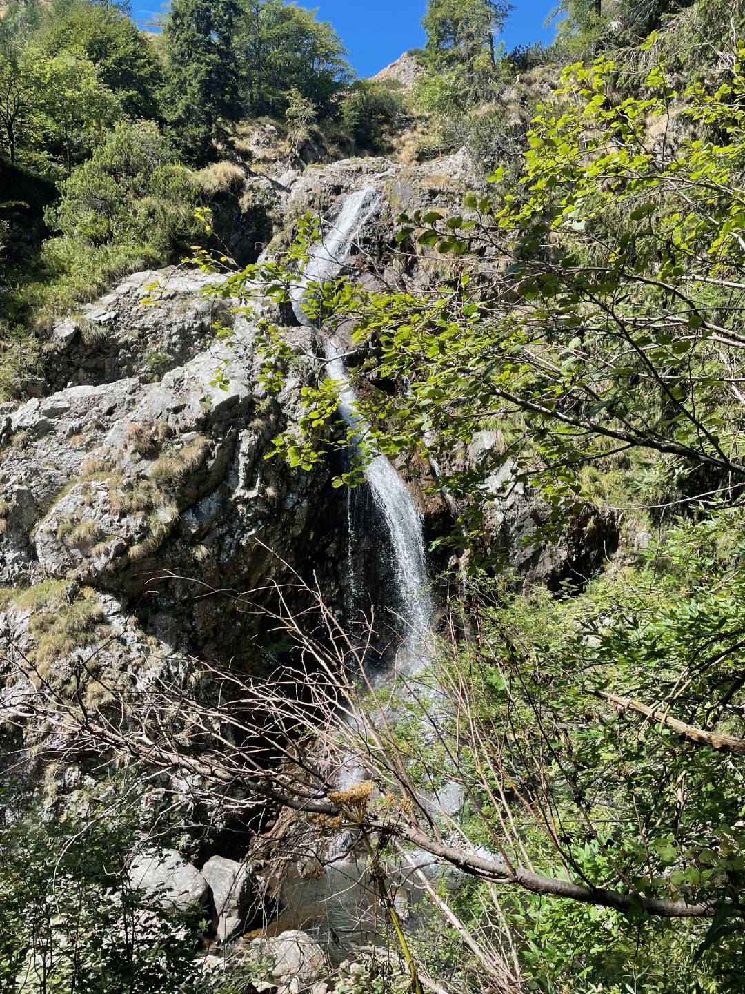
Waterfall of about 20 metres of the Torrente Mora just downstream of the flat land around the dam, clearly visible from the Via Mercatorum trail.
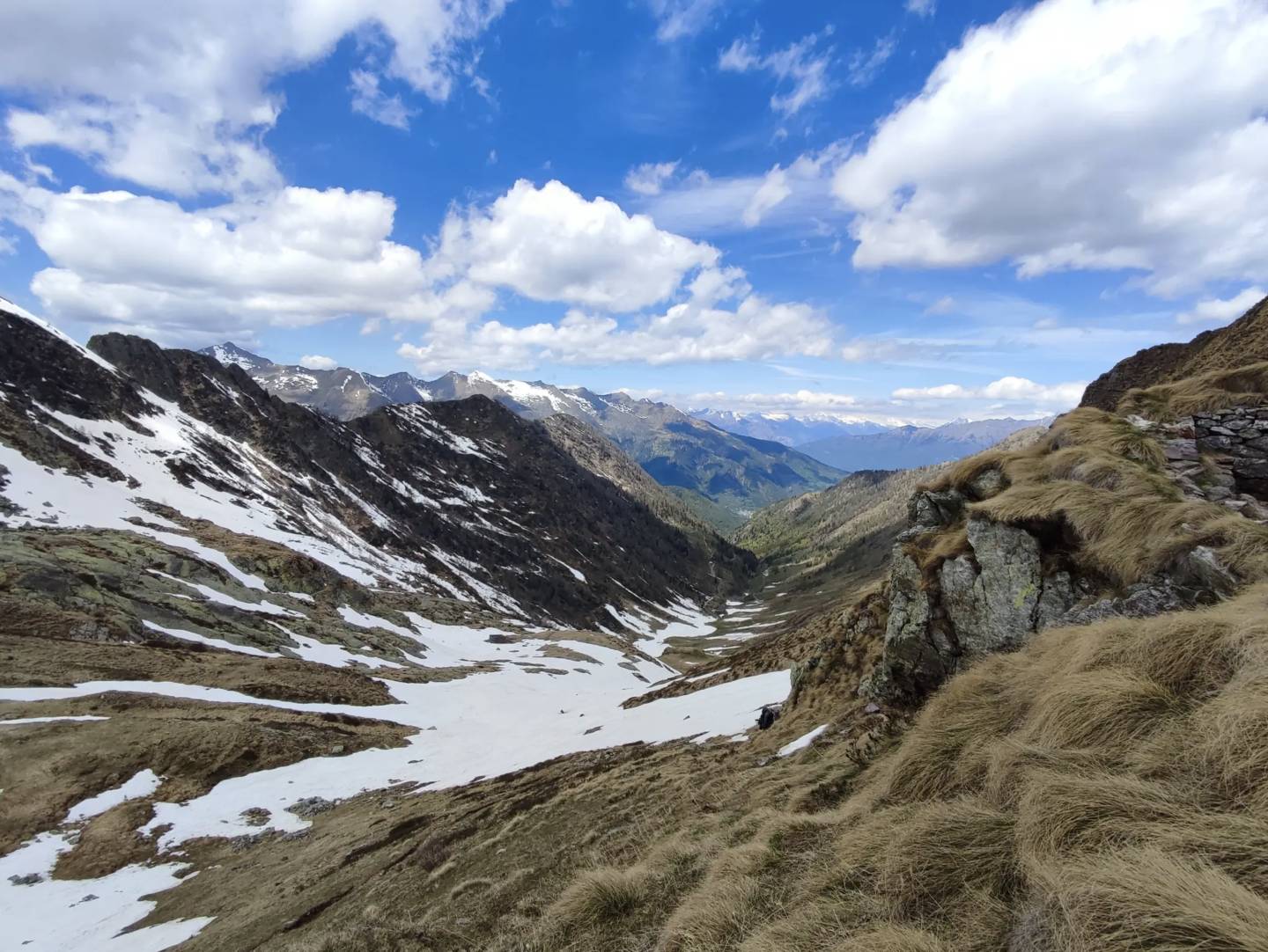
Known as “buchéta de Bumìgn” on the Valtellina side, and “pàs de Véròbi” on the Bergamo side. Near the pass are trenches and military outposts dating back to the First World War. There are numerous remains of military structures built during the Great War, when it was feared that an eventual breakthrough of the Austrians on the Stelvio Front or an invasion of neutral Switzerland would have made the Orobic ridge a strategically important front. Observing the wide saddle at the pass, one notices the remains of communication trenches, fortified buildings and even an entire cave carved into the rock (on the east side of the pass), with loopholes enabling observation of the Bomino valley. Near the pass there is a pool of water, and just below, a small lake (Laghetto di Verrobbio). The historical importance of this pass has ancient roots. Until 1593, the year in which the famous Priula Way was opened, Verrobbio was perhaps the most important Orobic pass, because of the passage of the very important trade route that led from Bergamo (in other words, long before 1428, when the Serenissima Republic of Venice took control) to Valtellina and the Germanic-speaking countries to the north. It was a very busy road in the Middle Ages, known by its Latin name, “Via Mercatorum,” the merchants’ way. At the end of the 16th century, the more practical Priula Way supplanted the Mercatorum Way, which, however, has not lost its historical charm (cf. M. Dal Cas).