Comune di Zogno

The Taverna Road is a mule track that ascends the ridge separating the Val Brembilla and Val Brembana valleys, on the boundary line between the municipalities of Val Brembilla and Zogno. A number of sources mention it as an “ancient” road, whose original name was Strada Meneghina (Meneghina Road) because of a settlement with this name on the route. It starts near the Sedrina bridges and the historic Ponte Cappello bridge, at the mouth of the Brembilla Valley. It climbs steeply, reaching and running through several small rural settlements, gaining altitude until it arrives at the meadowy slopes of Castignola and the hamlet of Catremerio. With the name of Taverna Road, it runs as far as the Forcella di Crosnello (Crosnello saddle) further up. After that, the route reaches the Sussia hamlets on the slopes and then it branches in various directions, either descending towards San Pellegrino or heading to the mountain pastures around Monte Sornadello or to the Mercante del Ferro Pass, whose name (Iron Merchant) recalls the transport of ore from the Valtorta mines. Several questions still remain regarding the origins, dating and destinations of this communication route, whose importance is underlined by the indisputable value of its structural elements, particularly in the first section of the route, up to Castignola. The route is signed as CAI path n° 592.

Tracciato Storico

Itinerario escursionistico

Difficoltà:
Lunghezza percorso: 7180m
Dislivello: 860m
Tempo di percorrenza: 3 ore
Note: "Segnaletica: placche metalliche e in legno discontinue, tacche bianco rosse.
Connessioni con trasporto pubblico: S.Antonio Abbandonato, Ponti di Sedrina.
Ricettività: Sant’Antonio Abbandonato.
Altri percorsi escursionistici convergenti: CAI 592A per Magnavacche; 592b per Brembilla; 595 per Monte Foldone; connessione e tratto comune alla Via Priula escursionistica da Ponti di Sedrina a Meneghina."
ST1

Shrine.

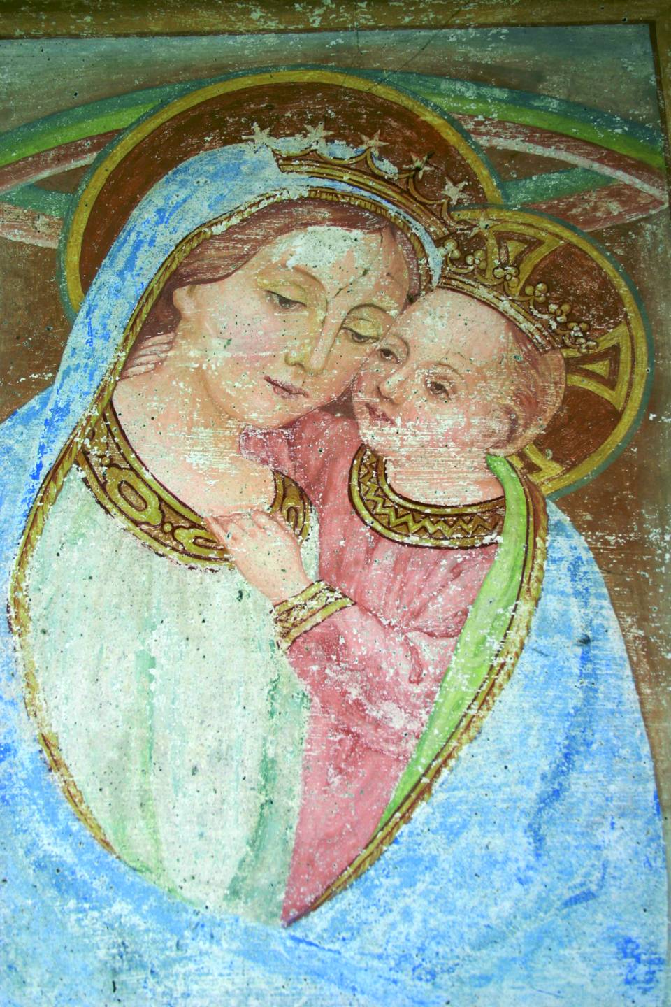
Situated along the first stretch of the Taverna Way, it depicts the Madonna and Child, Saint George and Saint Cajetan. Mary’s face is beautifully tender. The shrine’s date of construction is unknown. A second shrine, dedicated to Pope John XXIII, is located a little further uphill.

ST2

Walls of Ca’ Marta.

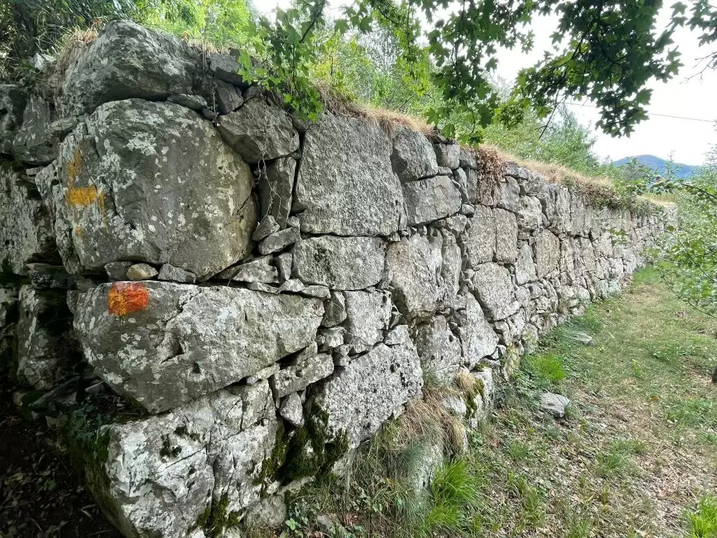
These are five terraces, in vertical sequence, providing additional land for farming, with a massive support structure, consisting of gigantic boulders – the largest are at the corners – reminiscent of the Peruvian terraces of Machu Picchu. “In fact, the boulders themselves appear to have been squared and laid in perfect balance, even though each rock weighs hundreds of kilos. The structure is therefore different with respect to the traditional dry-stone walls, which are far more recent than these Orobic ‘megalithic walls.’ Given their size, it would be difficult to assume that they were used just to build terraces or mark the boundaries of surrounding pastures. A mystical purpose is more likely, as suggested by Adriano Gaspani, a member of the staff at the Brera Astronomical Observatory (Milan). In one of his studies, the researcher from Bergamo advanced the hypothesis that the structures were created by an organised community present in the area between the 4th and 3rd centuries B.C. with the idea of arranging the walls according to specific positions of the sun.”

ST3

Church of San Gaetano (Saint Cajetan).

Located in the district of Prato Nuovo and on the road to Carnito at the intersection with the Taverna Road, it has very simple forms. However, there is a small altar with a splendid stucco frame. Date of construction: 18th century.