

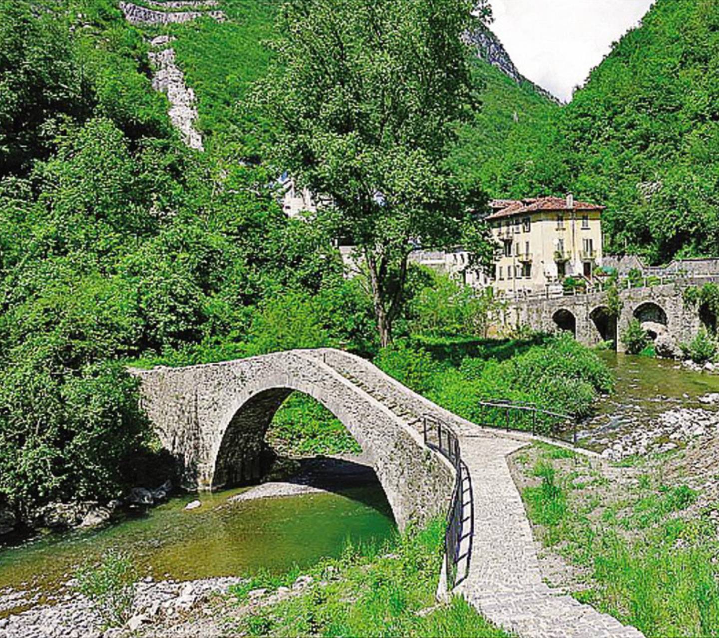
Historic stone arch bridge over the T. Brembilla near the beginning of Strada Taverna. The name of the Cappello bridge probably derives, as Professor Giuseppe Pesenti hypothesizes, from the Capelli family, one of the last who lived in the house adjacent to the bridge, called the “DEL NEGRO” house, until the end of the 1950s. Therefore it is not an ancient name, because in a Napoleonic map of 1812 the bridge is reported with the name of “Ponte di Ubiale”. The dating of the bridge to the medieval period is not documented by certain sources. It is hypothesized that the bridge was built around 1235, at the same time as the bridge called Attone in Clanezzo, and was used by the Court of Lemine to connect its territory of dominion passing through the village of Ubiale, crossing the Brembilla stream to continue with a mule track called Via Meneghina or Strada Taverna which climbed the left orographic side of the Brembo river. The artifact was rebuilt, not without procedural issues, in 1802 (https://it.wikipedia.org/wiki/Ponte_del_Cappello). To be noted, on the right orographic side of the bridge, the presence of the sculpture on a stone of the face of the lion with a mane. The stone with the lion’s face was set at the top of the parapet of the bridge, to seal the mark of the territorial dominion of the Republic of Venice, which began in 1428 and ended in 1797. Following the collapse of the bridge, due to a violent flood that occurred shortly after the end of the power of the Serenissima, negotiations were started for its reconstruction
This is an example of 18th-century rural architecture: the old tavern, the fountain, the dairy, the arch leading to the small square, perhaps once closed by a gate, and the chestnut drying structure. The origin of the name of this location may be derived from the surname of the wealthy Moroni family, but it could also refer to the name of a type of chestnut tree that was present in large numbers until the 1950s, in the area immediately around the district. This proposal is supported by the fact that there is still an ancient walled structure used for drying chestnuts. The earliest settlements in Maroncella may date back to the second half of the 16th century, while in the first half of the 18th century, the rural village reached its maximum expansion; the numerous dates engraved in the arches of the dwellings, “1717, 1725, 1744, 1725, G. 1750 C., P. 1792 V” confirm this. The district is surrounded by terraced meadows that, up until the 1950s, were regularly cultivated and planted with maize, rye, wheat, potatoes, beans and even coffee, which in those days was mixed with roasted acorns. In addition, large numbers of fruit trees – apples, pears, chestnuts, figs, persimmons, walnuts and plums – were present in the surrounding pastureland.
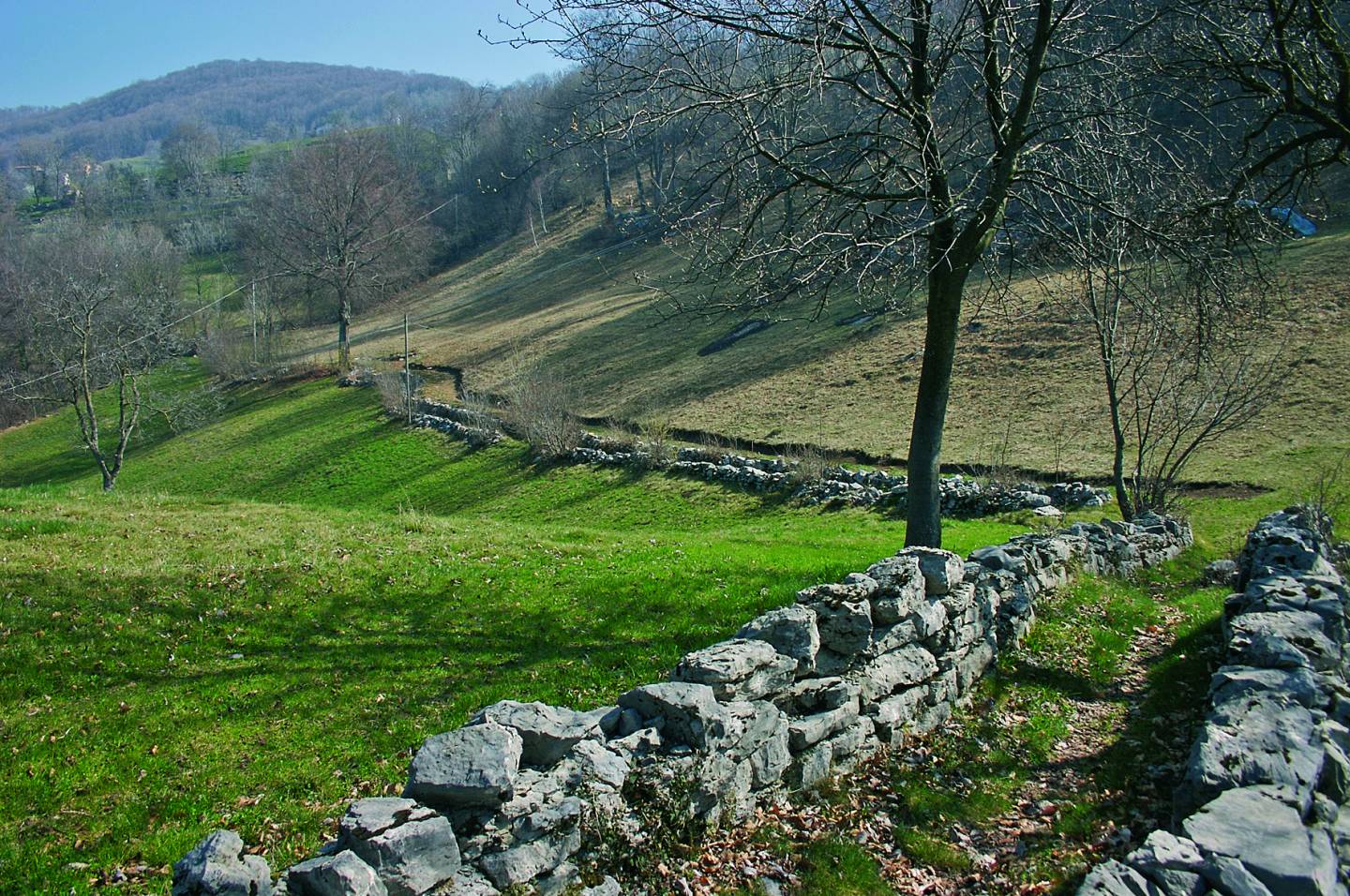
Around the two rural settlements of Castignola, at an average altitude of 900 metres, there is still a notable presence of certain traditional agricultural landscape features. In addition to the meadows and vegetable plots, the path has an unusual layout, running between low dry-stone walls, which prevent cattle from entering other people’s property, and it is bordered by trees. Locally, these paths are called sapéi (enclosures bordered by hedges). A tavern, that perhaps gave the path its name, was possibly located in one of the buildings of Castignola di Là: it comprises a large room with a flagstone floor and a central fireplace. On the entrance architrave the carved date 1607 can be seen, the earliest date discovered in the districts of Brembilla.
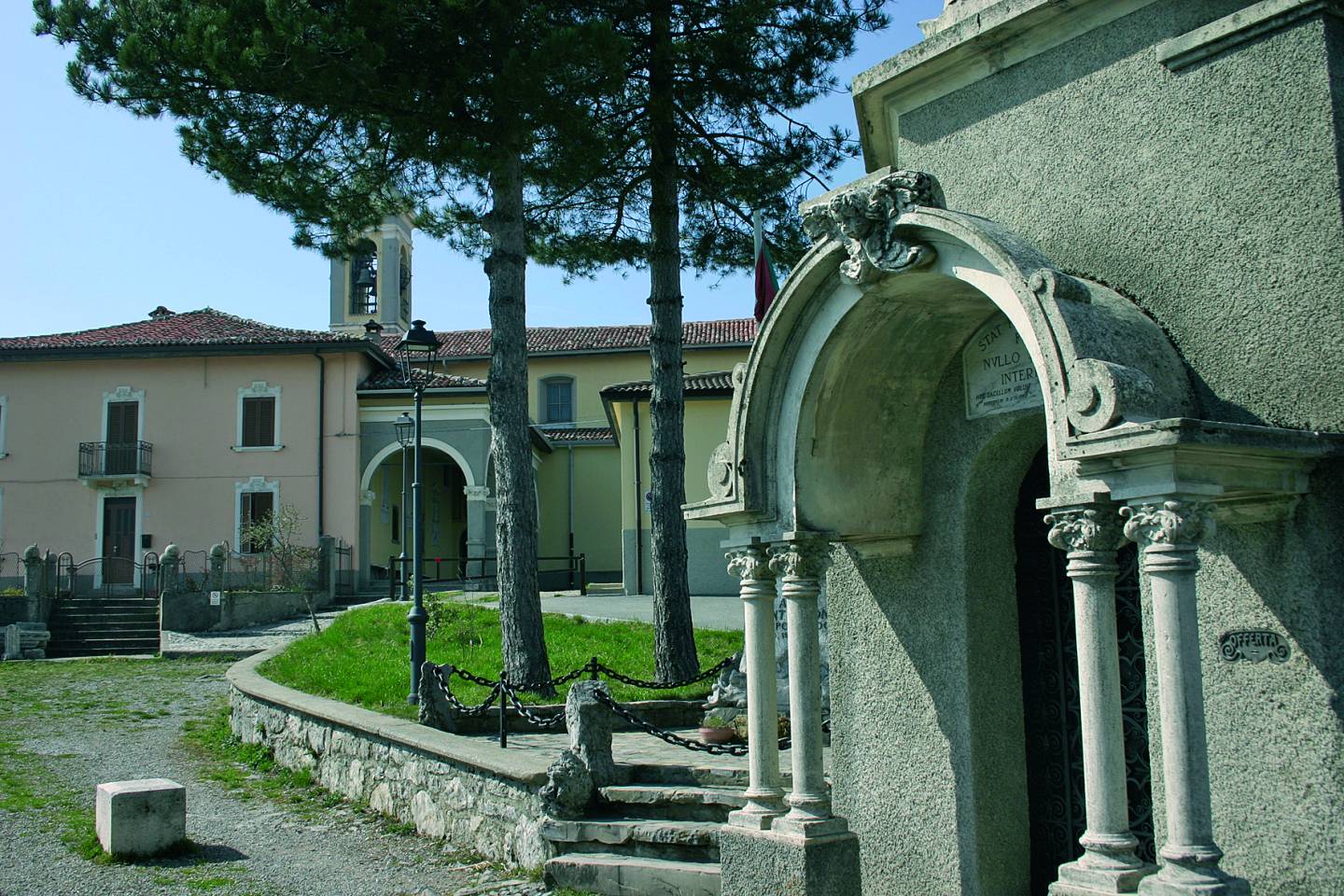
Documents dating back to 1440 mention a chapel dedicated to Saint Anthony in Castignola. In 1500, a hermit who performed pastoral duties was offered accommodation there. In the early 1800s, a new church was built utilising a fund left by a number of Sant’Antonio’s parishioners. The parish was formed on 22 July 1887 comprising about ten districts: Prisa Alta, Prisa Bassa, Zernione and Colle, belonging to the municipality of Zogno; Castignola di Qua and Castignola di Là, Tiglio, Moia, Caìs, Muraca and Stalla, belonging to the municipality of Brembilla. The frescoes on the vaulted ceiling were painted by Umberto Marigliani, who depicted scenes from the life of Saint Anthony, the Evangelists, Saint Charles and Saint Gregory Barbarigo and, in the bowl above the altar, the Eucharistic supper. A canvas by Carlo Ceresa (1630) depicting Christ Crucified, Saint Sebastian, Saint Roch, Saint Francis of Assisi and Saint Nicholas of Tolentino, was brought from the old church. Near the church and the sports ground, there is one of the finest panoramic views in the entire Brembilla Valley, looking over the plains. On clear days, the Apennines of Emilia Romagna can easily be seen, along with many buildings on the Lombard plain.
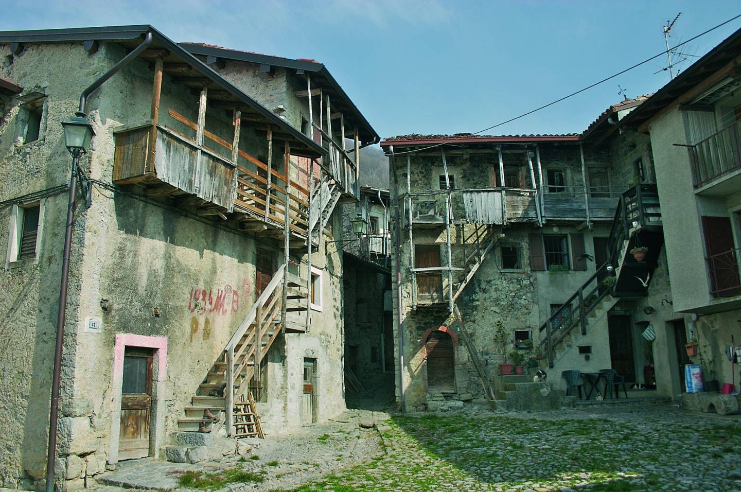
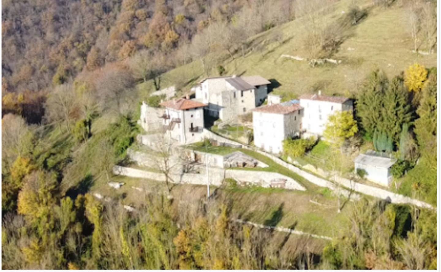
After restoration work in the early 1990s, promoted by voluntary groups, Catremerio has become a symbol and a popular destination for cultural tourism. Here, certain characteristics of the rustic mountain village can be seen, with elements well preserved still today and providing an eloquent account of the ancient rural activities, through architectural elements typical of rural 16th and 18th-century houses: vaulted interiors (silter), wooden balconies linking the houses, tiled roofs, chimney pots, drainage channels incorporated into the paving, votive shrines and countless other details. Many of the houses are still inhabited, and the village’s rural vocation is very obvious, as shown for example by the numerous small stables. Catremerio comprises two separate groups of buildings: Catremerio di Qua, degli Sgarbui (“Catremerio on this side, with the lawyers”) and Catremerio di Là’, dei Balos (“Catremerio on the other side, with the rogues”), situated near the Church of San Cajetan. In the former, the dwellings are arranged in a circle and face a small piazza where the enchanting architectural features of external wooden staircases, balconies and loggias connecting the houses can easily be seen. The houses were built in about the 18th century, as demonstrated by the dates 1738 and 1754 carved on the entrance arches. Also interesting is the unusual portico running across a house and leading to the mule track which leads to the other group of buildings and the church. On the ground floor of the various dwellings, the rooms are in silter (vaulted) configuration, originally used as stables, with stone-flagged kitchens alongside. Inside, some still have the old fireplace, pegna (stove) and sideboard. The doors and windows are of different sizes and shapes, but mostly arched. In the centre of the narrow lane that runs through the hamlet of Catremerio, there is a small channel for rainwater, which collects it and takes it down towards the valley; there are numerous fountains and wash-houses near the hamlet. The second hamlet, which includes the engraved dates 1546 and 1581 on the arches of some of the doors, and a 16th-century fresco depicting the Pietà and the Carminati family coat of arms, extends along the mule track that leads from the church to the cemetery, with some original houses and others that have been renovated. The small church dates back to the early 19th century, built onto an 18th-century chapel dedicated to San Gaetano (Saint Cajetan), patron saint of Catremerio. The small church was extended on several occasions, reaching its current appearance in the early 20th century, at a time when the village had 310 inhabitants and became an independent parish, breaking away from Brembilla. Since 1986, the parish of San Gaetano di Catremerio has been part of Sant’Antonio Abbandonato.
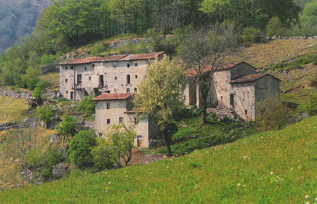
This village is on a small rocky ridge, surrounded by extensive meadows and a mature beech forest. The hamlet comprises a group of houses and stables in ancient stone, dating back to the late 16th century. Since the end of the Second World War, the hamlet has been uninhabited and only farmers go up there to graze their cattle. Unusual features include the conformation of the retaining walls, the slaàcc (water troughs) and the many bird traps at the top of the ridge, forming a veritable botanic garden.